Swakopmund has two high tides and two low tides almost every day, with a fairly small range of roughly 1–2 m between high and low water. Use the tide table on this page to see the predicted high and low tides for Walvis Bay for the coming days; Swakopmund’s tides differ by only a few minutes. Tides matter most if you are planning a Sandwich Harbour tour, surfing at Skeleton Bay, fishing from the beach or driving anywhere near the shoreline.
This guide explains how tides work on the Namibian coast, why they decide the timing of some of the area’s best trips, and how to stay safe on the beach.
Live tide predictions
Walvis Bay & Sandwich Harbour tide times
Predicted high and low tides in Namibian time (CAT, UTC+2). Swakopmund is within a few minutes of these times.
Low-tide window (approx. ±2 h): when the Sandwich Harbour beach route is usually driven
Predictions are computed from long-term harmonic tidal constants and are not official navigation data. Wind, swell and air pressure can shift actual levels by 20–30 cm. Tour operators make the final call on Sandwich Harbour.
Tidal constants: TICON-4 (Hart-Davis, Dettmering & Seitz, 2025), CC BY 4.0, calibrated to Walvis Bay.
How to read the tide table#
The tide widget on this page shows predicted high and low tides for Walvis Bay, the official reference port for this stretch of coast.
- High tide is when the water reaches its highest point in the cycle; low tide is the lowest point.
- Tide heights are measured from a chart datum, a reference level close to the lowest tides, so a “low” tide can still show a positive number.
- For Swakopmund, use the Walvis Bay times; the difference is only a matter of minutes, which is smaller than the effect of wind and swell on any given day.
How tides work on the Namibian coast#
Two tides a day (semi-diurnal)#
The coast of Namibia has a semi-diurnal tide: about two high tides and two low tides every lunar day, which lasts about 24 hours and 50 minutes. That means:
- High and low tides are roughly six hours and a quarter apart.
- Each tide arrives about 50 minutes later than the day before, so a morning low tide drifts into the afternoon over the course of a week.
- Occasionally a day has only three turning points instead of four because one slips past midnight.
A small range#
Compared with places like northern France or the UK, the tidal range here is modest, typically somewhere around 1–2 m between high and low water. Do not let that fool you: on a flat, gently sloping beach, a rise of a metre can move the waterline tens of metres inland, and on a narrow strip under the dunes it can cover the whole beach.
Spring and neap tides#
The range changes through the month with the moon:
- Spring tides (nothing to do with the season) occur around full moon and new moon, when the sun and moon pull in line. High tides are higher and low tides lower.
- Neap tides occur around the half moons, when the range is smallest.
- The cycle repeats roughly every two weeks.
Spring high tides are the ones that wash furthest up the beach and close beach routes completely. Spring low tides expose the most sand and rock, which is good news for beach walks and rock pools.
Wind and swell matter too#
The Benguela coast is exposed to big South Atlantic swells and strong south-westerly winds. A large swell or an onshore wind can push water higher than the predicted tide, while calm offshore conditions can make it lower. Experienced guides read all three: tide, swell and wind.
Why tides matter for Sandwich Harbour#
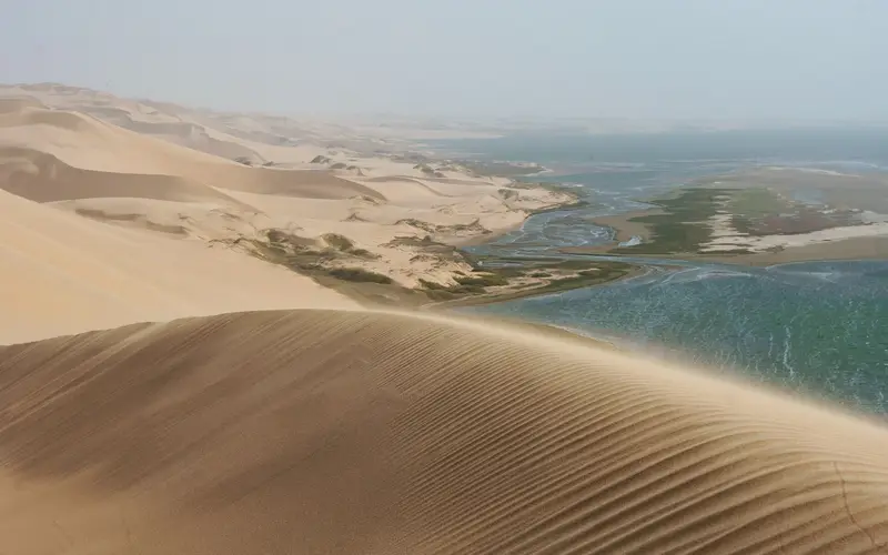
Sandwich Harbour, about 42 km south of Walvis Bay, is where the Namib’s dunes plunge straight into the Atlantic, and it is the place where tides matter most for visitors.
- The beach route is tidal. Vehicles drive a narrow strip of sand between the dunes and the surf. Around low tide it is open; at high tide the waves wash right up against the base of the dunes and the route is impassable.
- Tours are timed around low tide. Operators set their departure times so that the beach section is driven in the low-tide window. This is why the same tour can leave in the morning one week and around midday the next, and why your departure time may only be confirmed the day before.
- Spring tides shrink the window. Around full and new moon, operators may shorten the beach section, reroute over the dunes or have guests walk the final stretch.
- Big swell can close it entirely. Even at low tide, a heavy swell can make the beach unsafe. Good operators will reschedule.
Use the tide table on this page to see whether the low tide on your possible day falls in the morning or afternoon, then confirm with your operator. You can compare bookable tours in the widget on this page, and read about combining a tour with a dolphin cruise in our Walvis Bay day trip guide.
Pelican Point and Skeleton Bay surfing#
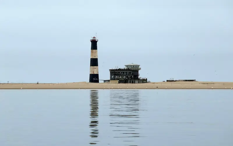
Pelican Point is the long sand spit that shelters Walvis Bay, with a lighthouse, seal colonies and kayak tours. The spit is low-lying, so the shoreline changes noticeably with the tide, and kayak and 4x4 operators plan their trips around conditions.
On the outer side of the spit is Skeleton Bay, one of the longest left-hand barrels in the world. For surfers:
- The wave depends on a narrow window of swell size and direction, mostly in the southern winter. Tide is one factor among several, and the wave changes character through the tide.
- Strong tidal rips and backwash run along the point, so currents can be fierce. It is a wave for advanced and expert surfers.
- Many surfers check the tide table alongside the swell forecast to decide when to paddle out and how long a session can last.
Read our Skeleton Bay surfing guide before you go.
Fishing and angling#
Shore angling is a way of life on the coast between Swakopmund and Henties Bay, and many anglers plan their day around the tide.
- Many anglers prefer fishing the incoming tide and the time around high water, when fish move closer to the shore to feed. Others prefer the hour or two either side of low tide on particular gullies. Ask at local tackle shops, which know what is biting.
- Low spring tides are a good time to scout the beach and see gullies, sandbanks and rocks that are hidden at high water.
- You need a recreational angling permit from the Namibian fisheries authorities, and bag limits, size limits and closed seasons apply. Check the current rules before you fish.
- Driving to fishing spots: stick to designated tracks. Much of the coast north of Swakopmund is part of the Dorob National Park, where off-road driving is restricted.
Beach walks, rock pools and birds#
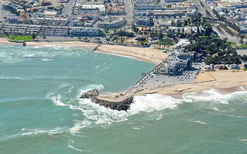
- Beach walks: low tide gives you the widest, firmest sand. The walk south from the Mole towards the Swakop River mouth, or along the beaches north of town, is easiest around low water. See our Swakopmund beaches guide.
- Rock pools: a low spring tide exposes the most rocks and pools along the rocky stretches of shore.
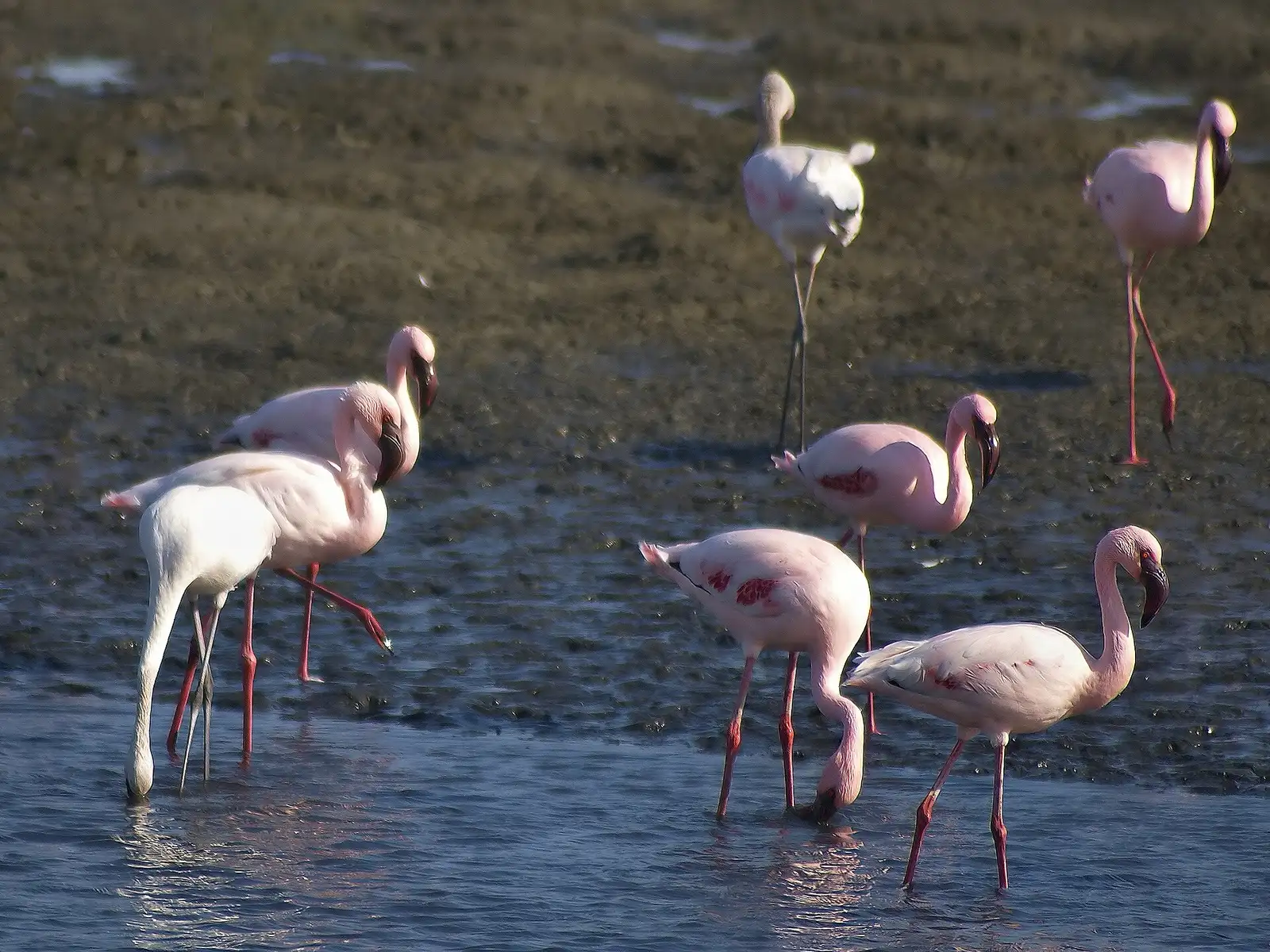
- Birdwatching at Walvis Bay lagoon: flamingos and waders spread out across the mudflats at low tide and are pushed closer to the shore as the water rises, so a rising or high tide often brings them nearer the promenade. Read our Walvis Bay travel guide.
- Sunsets at the jetty and Mole: at high tide with a decent swell, waves crash dramatically against the rocks. Watch from a safe distance.
Beach safety on a tidal coast#
The Namibian coast is beautiful but not a gentle swimming coast.
- Cold water. The Benguela current keeps the sea cold all year, so cold shock and hypothermia are real risks even on a sunny day.
- Rogue waves. Sets of larger waves can surge much further up the beach or over rocks than the waves before them. Never turn your back on the sea on rocks, the Mole or the jetty area, and keep children close.
- Currents. Rip currents form on open beaches at any tide. Swim only in sheltered spots like Palm Beach, never alone, and stay out when it is rough.
- Beach driving. Never drive the beach on a rising tide, never park below the high-water line, and remember that rental agreements usually exclude beach driving. See is Swakopmund safe.
- Fog. Thick coastal fog can roll in quickly and make it hard to judge distance to the water. Turn back early.
When is the best time to visit for tide-dependent trips?#
There is no bad season for tides; they run on the same pattern all year. What changes is the weather:
- Summer (December–March): busiest season, more wind in the afternoons.
- Winter (May–August): foggy mornings and the occasional hot east-wind day; the main Skeleton Bay surf season.
Our Swakopmund weather and best time to visit guide has the details, and the best day trips from Swakopmund shows how to fit a tide-dependent trip into your plans.
Common mistakes#
- Planning Sandwich Harbour on your last day. If the tide or swell forces a change of time, you need flexibility.
- Assuming the tide is at the same time every day. It moves about 50 minutes later each day.
- Parking on the sand for a photo. The tide can reach a parked car faster than you expect.
- Ignoring wind and swell. A good tide on paper can still be a bad beach day.
- Using a tide app for navigation. Use official sources for anything on the water.
For everything else to plan around the coast, see our Swakopmund travel guide and the full list of best things to do in Swakopmund.
Photo gallery
Frequently asked questions
How many tides are there a day in Swakopmund?
Usually two high tides and two low tides, roughly six hours and a quarter apart. Because the cycle is slightly longer than 12 hours, each tide comes about 50 minutes later than the day before.
Are Swakopmund and Walvis Bay tides the same?
Almost. The two towns are only about 35 km apart on the same open coast, so tide times differ by just a few minutes. Walvis Bay is the official reference port, which is why most tide tables, including the one on this page, use it.
Why do Sandwich Harbour tours depend on the tide?
The usual route runs along a narrow beach between the dunes and the sea that is only passable around low tide. At high tide waves reach the foot of the dunes, so operators set departure times around the tide and may change them at short notice.
What are spring and neap tides?
Spring tides happen around full and new moon, when high tides are higher and low tides lower than usual. Neap tides fall around the half moons and have the smallest range. Spring high tides push water furthest up the beach and are the most important to watch.
Can I swim at Swakopmund at any tide?
Palm Beach next to the Mole is the most sheltered spot, but the Atlantic here is cold all year and currents can be strong at any tide. Swim only where others do, never alone, and stay out when the sea is rough.
Is the tide table on this page official?
No. It shows astronomical predictions for planning a beach walk, tour or fishing trip. Wind, swell and air pressure can make actual water levels higher or lower, and it must not be used for navigation. Tour operators and the port authorities make the final call.