Windhoek to Swakopmund is about 360 km on tarred roads, which takes 4 to 4.5 hours of driving: north on the B1 to Okahandja, then west on the B2 through Karibib, Usakos and Arandis to the coast. Without a car, the easiest options are a daily shared shuttle with door-to-door pickup (approx. N$450–N$800 one way in 2026) or the Intercape bus. There is no regular scheduled flight between Windhoek and Walvis Bay at the moment, and passenger trains are suspended.
This guide covers the route stop by stop in both directions, the Spitzkoppe detour, fuel, shuttle timetables, buses and flights. For an overview of all ways into town, including flights from South Africa straight into Walvis Bay, see how to get to Swakopmund. Prices and timetables change, so confirm when you book.
Distances
How far is it from Swakopmund?
Road distances and realistic driving times from the town centre. Gravel roads are slower than they look on a map.
| Destination | Distance | Drive time | Road |
|---|---|---|---|
| Mondesa township | 4 km | 10 min | tar |
| Dune belt (sandboarding & quads) | 6 km | 10 min | tar |
| Walvis Bay Waterfront | 35 km | 30 min | tar |
| Moon Landscape | 35 km | 40 min (gravel) | gravel |
| Dune 7 | 38 km | 35 min | tar |
| Walvis Bay Lagoon (flamingos) | 38 km | 35 min | tar |
| Goanikontes Oasis | 40 km | 50 min (gravel) | gravel |
| Zeila shipwreck | 60 km | 45 min | tar |
| Pelican Point | 65 km | 1 h 30 (4x4 only, or by boat) | 4x4 |
| Welwitschia Plains | 65 km | 1 h 15 (gravel) | gravel |
| Henties Bay | 75 km | 50 min | tar |
| Sandwich Harbour | 80 km | 2 h (4x4 only, tide-dependent) | 4x4 |
| Cape Cross Seal Reserve | 125 km | 1 h 30 | gravel |
| Spitzkoppe | 150 km | 2 h | gravel |
| Brandberg | 220 km | 3 h | gravel |
| Windhoek | 360 km | 4 h | tar |
| Sossusvlei | 400 km | 6 h (mostly gravel) | gravel |
Your options at a glance#
| Option | Time | Approx. cost (2026) | Best for |
|---|---|---|---|
| Self-drive | 4–4.5 h (4.5–5 h from the airport) | Fuel approx. N$700–N$1,100 for a small car, plus rental | Flexibility, groups, onward road trips |
| Shared shuttle | 4.5–5.5 h with pickups | approx. N$450–N$800 per person | Solo travellers and backpackers |
| Intercape bus | approx. 5 h | approx. N$350–N$650 | Budget travellers on a fixed date |
| Private transfer | approx. 4.5 h | approx. N$3,500–N$6,000 per vehicle | Families and groups who don’t want to drive |
| Fly (via Johannesburg or Cape Town, or charter) | Varies | Expensive | Rarely worth it from Windhoek |
Driving from Windhoek to Swakopmund#
The route, kilometre by kilometre#
| Point | Approx. km from central Windhoek | What’s there |
|---|---|---|
| Windhoek | 0 | Last big supermarkets and best fuel choice |
| Okahandja | 70 | Fuel, supermarkets, woodcarvers’ markets; turn west onto the B2 just north of town |
| Karibib | 185 | Fuel, takeaways; marble and mining town |
| Usakos | 215 | Fuel, shops; old railway town |
| Spitzkoppe turn-off (D1918) | approx. 235 | Gravel detour north to Spitzkoppe |
| Arandis | approx. 295 | Small mining town near the Rössing uranium mine |
| Swakopmund | approx. 360 | You have arrived; the coastal fog usually appears in the last 30 km |
From Hosea Kutako International Airport, follow the B6 west for about 45 km towards Windhoek, then pick up the B1 north. Using the city’s western bypass avoids most of the central traffic. Total from the airport: about 400 km.
Road conditions#
- Tar all the way. The B1 between Windhoek and Okahandja has been upgraded to dual carriageway in sections; the B2 is a good two-lane highway with occasional roadworks.
- Trucks: the B2 is the main freight corridor between Walvis Bay port and the interior. Expect slow, heavy lorries, especially on climbs. Overtake only with a long, clear view.
- Speed limits: 120 km/h on the open road, 60 km/h (sometimes 80 km/h) through towns. Speed traps are common near Okahandja, Karibib and Usakos.
- Wildlife and livestock: kudu, warthog, goats and cattle cross at dawn and dusk. Don’t drive the B2 after dark.
- Wind and sand: near the coast, strong winds can blow sand across the road; slow down.
Fuel#
Fill up in Windhoek and top up at Okahandja, Karibib or Usakos if you want a margin. In October 2026, petrol (95) cost N$26.58 and 50 ppm diesel N$27.86 per litre at Walvis Bay, the coastal base price, with inland towns slightly higher. A small car using 7–8 litres per 100 km needs around 25–30 litres for the trip; a 4x4 double cab nearly twice that. Most stations on this route take cards, but keep some cash for the attendant’s tip (N$5–N$10). More money tips in our Namibia currency guide.
Where to stop along the way#
Okahandja (approx. 70 km). The last large town before the coast, with fuel, supermarkets and two well-known roadside woodcarvers’ markets at either end of town, where you can buy carvings straight from the makers (bargain politely, and pay cash). Okahandja is also an important place in Herero history, with the graves of several Herero leaders in town.
Karibib (approx. 185 km). A small town built on marble, granite and gold mining. Good for a fuel and toilet stop, a cold drink and a stretch of the legs.
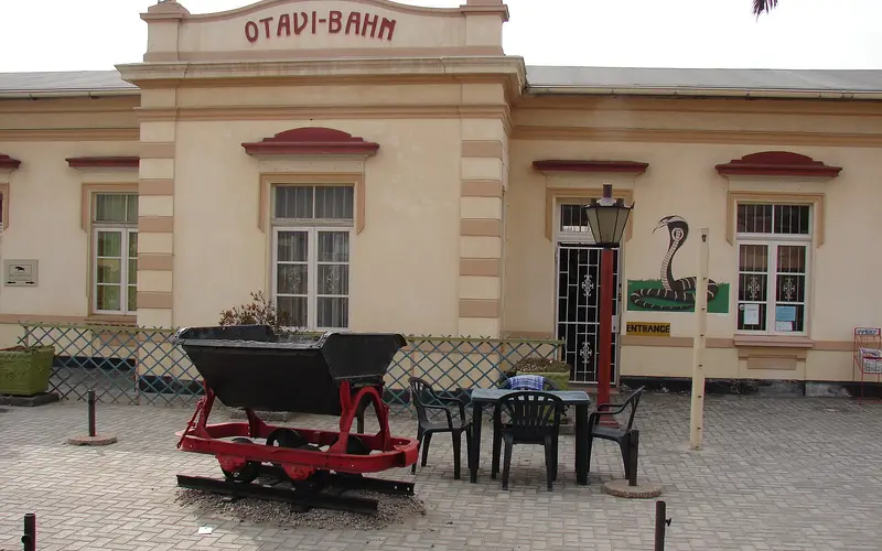
Usakos (approx. 215 km). An old railway town on the dry Khan River, and the gateway to the Erongo Mountains to the north, known for granite scenery and rock art. It is also the last proper fuel stop before the coast.
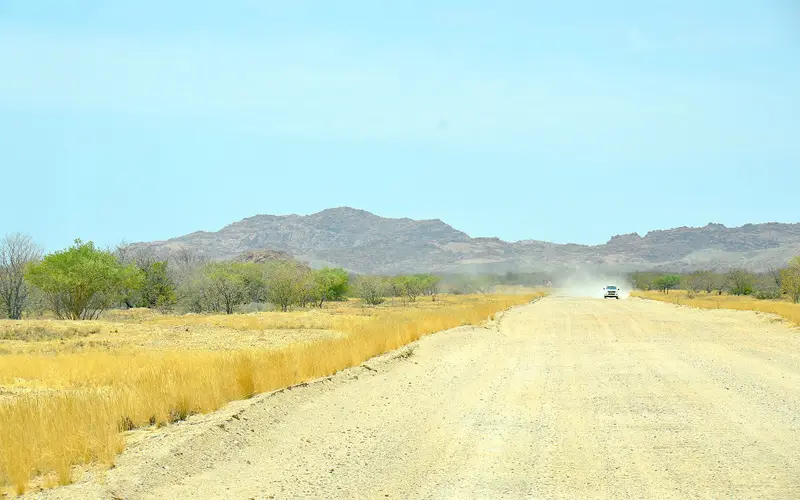
The Spitzkoppe detour (from approx. 235 km). About 20 km west of Usakos, a gravel road (the D1918, then the D3716) leads north to Spitzkoppe, the granite peak often called the “Matterhorn of Namibia”. It is about 30 km of gravel each way, so the detour adds roughly 60 km and 2–3 hours including a short visit, plus community entry fees. On a day you have flown in, it makes for a very long drive; it is better done as a day trip or overnight from Swakopmund. Our Spitzkoppe day trip guide has the route, fees and camping details.
Arandis to the coast (approx. 295–360 km). The landscape flattens into pale gravel plains, with the Rössing uranium mine nearby. Watch the temperature gauge drop as the coastal fog bank appears; it is often 10–15°C cooler in Swakopmund than in Windhoek.
The scenic gravel alternative: C28 via the Bosua Pass#
The C28 runs more directly west from Windhoek through the Khomas Hochland and down the steep Bosua Pass into the Namib. It is shorter on the map but slower in reality: gravel, remote, with little fuel or mobile signal, and a very steep descent where a high-clearance vehicle is strongly advised. Allow 5–6 hours or more, travel in daylight only, and check that your rental agreement allows it. Our car rental guide explains gravel-road insurance.
Driving tips#
- Don’t drive to the coast on the day you land after an overnight flight; spend a night in Windhoek. Fatigue on long straight roads is a major cause of accidents.
- Leave by early afternoon so you arrive in daylight, especially in winter when the sun sets around 18:15.
- Keep valuables out of sight at fuel stops, and lock the car even if you only pop in to pay.
- One-way rentals: picking up in Windhoek and dropping off in Walvis Bay or Swakopmund usually costs a one-way fee.
Shared shuttles#
Shared shuttles are the backpacker’s favourite way between Windhoek and the coast. Minibuses collect you from your accommodation and drop you at the door.
Welwitschia Shuttle#
Welwitschia Shuttle publishes this daily scheduled service (check it is current when you book):
| Direction | Pickups | Stops | Arrival |
|---|---|---|---|
| Windhoek → Swakopmund | Collection 12:00–13:00; last pickup at the German Lutheran Church on Fidel Castro Street at 13:00 | Okahandja 14:00, Karibib 15:00, Usakos 15:30 | Swakopmund approx. 17:30, then drop-offs |
| Swakopmund → Windhoek | Swakopmund pickups 06:15–06:40 (Walvis Bay 06:00–06:15 on weekdays); departs 07:00 | Usakos 08:30, Karibib 09:00, Okahandja 10:00 | Windhoek approx. 11:00, then drop-offs |
- The company says it does not collect from or drop off in some Windhoek suburbs, including Katutura, Khomasdal, Otjomuise and Wanaheda.
- Airport connections: Hosea Kutako transfers are arranged with a partner transfer company. Passengers on afternoon flights wait at a lodge on the edge of Windhoek before being taken to the airport, and early-morning arrivals can be collected and connected onto the Swakopmund shuttle.
- Walvis Bay: passengers continuing to Walvis Bay are transferred from Swakopmund (weekdays).
- Fares are given on request: book by WhatsApp, phone or the website.
Other shuttle operators#
- Town Hoppers (part of McClunes): daily shuttles between Windhoek, Swakopmund and Walvis Bay along the B2. Contact them for current departure times and fares.
- Carlos Shuttle & Tours and other smaller operators also run the route.
Approx. fare (2026): N$450–N$800 per person one way for a shared seat, depending on the operator and whether airport pickup is included.
Booking tips:
- Book 2–3 days ahead, or a week or more ahead in mid-December to mid-January and around Easter, when Namibians head for the coast.
- Confirm your pickup by WhatsApp the evening before, and give your flight number for airport pickups.
- Allow an extra hour compared with driving yourself because of pickups and drop-offs.
- Most hostels will book a shuttle for you; see our Swakopmund hostels guide.
Intercape bus#
Intercape runs coaches between Windhoek and Walvis Bay that stop in Swakopmund, taking around five hours. Coaches have reclining seats and a toilet, and leave from the Intercape office area in central Windhoek. Timetables and frequency vary by day and season, so check the current schedule on intercape.co.za or a booking platform rather than relying on old timetables.
- Approx. fare (2026): N$350–N$650 one way, cheaper when booked early.
- In Swakopmund: confirm the exact stop when you book, and take a short taxi ride to your accommodation, booked through your host.
- Good for: budget travellers on a fixed day. Not ideal for airport connections.
Flying from Windhoek to Swakopmund#
At the time of writing there is no regular scheduled flight between Windhoek and Walvis Bay, the nearest commercial airport to Swakopmund (approx. 40–45 km away). Domestic services on this route have started and stopped several times in recent years, so check FlyNamibia and Airlink for any new route before you plan around one.
The realistic flying options are:
- Fly into Walvis Bay from Johannesburg or Cape Town instead of Windhoek, which works well if you are connecting from a long-haul flight via South Africa.
- Light-aircraft or charter flights from Windhoek’s Eros airport, or fly-in safari services linking Swakopmund with Windhoek and lodges. These save a day of driving but are priced accordingly.
Swakopmund to Windhoek: the return trip#
The route is the same in reverse, but timing matters more because most travellers are heading for a flight.
- Driving to Hosea Kutako airport: about 400 km and 4.5–5 hours. For an evening long-haul departure, leave Swakopmund by about 10:00–11:00; for an afternoon flight, leave at first light or, better, spend the last night in Windhoek or near the airport.
- Returning a rental car: allow extra time for the vehicle inspection, especially for 4x4 campers, and refuel near the airport.
- By shuttle: the 07:00 Welwitschia departure (pickups from about 06:15) reaches Windhoek around 11:00 and connects with an airport transfer for afternoon flights.
- Don’t cut it fine. Roadworks, a puncture or a slow truck on a hill can easily cost an hour.
Common mistakes#
- Driving to the coast straight after an overnight flight. Spend the first night in Windhoek.
- Arriving after dark. Leave Windhoek by early afternoon at the latest.
- Assuming you can fly Windhoek–Walvis Bay. Check whether a route is actually operating.
- Booking shuttles last minute in December. Seats sell out.
- Planning Spitzkoppe on arrival day. The detour turns a 4-hour drive into an 8-hour day.
- Leaving bags visible in the car at fuel stations and markets.
Plan your time in Swakopmund#
Once you arrive, start with our Swakopmund travel guide and 3-day itinerary. If Swakopmund is part of a bigger loop, our Namibia road trip itinerary shows how to combine it with Sossusvlei and Etosha, and is Namibia safe covers road safety across the country.
Photo gallery
Frequently asked questions
How far is Windhoek from Swakopmund?
About 360 km by road from central Windhoek, via the B1 to Okahandja and the B2 through Karibib and Usakos. From Hosea Kutako International Airport it is about 400 km, because you first drive 45 km into Windhoek.
How long does it take to drive from Windhoek to Swakopmund?
Four to four and a half hours without long stops, on tarred roads all the way. Allow five hours or more with a coffee stop, roadworks and trucks, and add 45 minutes from the airport.
Is there a shuttle from Windhoek to Swakopmund?
Yes. Several companies, including Welwitschia Shuttle and Town Hoppers, run daily shared shuttles with door-to-door pickup and drop-off. Welwitschia's scheduled service leaves Windhoek around 13:00 and reaches Swakopmund around 17:30; the return leaves Swakopmund at 07:00.
Can you fly from Windhoek to Swakopmund?
Not on a regular scheduled airline in 2026. Swakopmund's airfield handles only light aircraft, and Walvis Bay airport is served mainly from Johannesburg and Cape Town. Light-aircraft and charter flights exist but are expensive.
How do I get from Swakopmund to Windhoek airport?
Drive about 400 km (4.5–5 hours), or take an early shuttle: Welwitschia Shuttle's 07:00 departure links with an airport transfer for afternoon flights. Leave plenty of time, as international check-in closes well before departure.
Is it safe to drive from Windhoek to Swakopmund?
Yes, in daylight. It is a good tarred road, but heavy trucks, speed traps, wildlife at dawn and dusk, and fatigue after long-haul flights are the main risks. Don't drive it at night or on the day you land after an overnight flight if you can avoid it.