The Skeleton Coast starts right on Swakopmund’s doorstep: drive north on the C34 salt road and within an hour you are on a fog-wrapped coastline of empty beaches, fishing camps and shipwrecks. An easy day trip takes in the Zeila wreck, Henties Bay and the huge seal colony at Cape Cross. The Skeleton Coast National Park proper begins at the Ugab River, about 200 km north, and needs permits, more fuel planning and ideally an overnight stay. This guide covers both options, plus guided tours, 2026 fees and what to pack.
Distances
How far is it from Swakopmund?
Road distances and realistic driving times from the town centre. Gravel roads are slower than they look on a map.
| Destination | Distance | Drive time | Road |
|---|---|---|---|
| Mondesa township | 4 km | 10 min | tar |
| Dune belt (sandboarding & quads) | 6 km | 10 min | tar |
| Walvis Bay Waterfront | 35 km | 30 min | tar |
| Moon Landscape | 35 km | 40 min (gravel) | gravel |
| Dune 7 | 38 km | 35 min | tar |
| Walvis Bay Lagoon (flamingos) | 38 km | 35 min | tar |
| Goanikontes Oasis | 40 km | 50 min (gravel) | gravel |
| Zeila shipwreck | 60 km | 45 min | tar |
| Pelican Point | 65 km | 1 h 30 (4x4 only, or by boat) | 4x4 |
| Welwitschia Plains | 65 km | 1 h 15 (gravel) | gravel |
| Henties Bay | 75 km | 50 min | tar |
| Sandwich Harbour | 80 km | 2 h (4x4 only, tide-dependent) | 4x4 |
| Cape Cross Seal Reserve | 125 km | 1 h 30 | gravel |
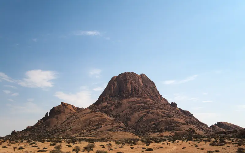
| Spitzkoppe | 150 km | 2 h | gravel |
| Brandberg | 220 km | 3 h | gravel |
| Windhoek | 360 km | 4 h | tar |
| Sossusvlei | 400 km | 6 h (mostly gravel) | gravel |
What and where is the Skeleton Coast?#
The name “Skeleton Coast” is used in two ways, and it helps to know the difference before you plan:
- The wider Skeleton Coast is the whole northern Namibian coastline, from roughly Swakopmund to the Kunene River on the Angolan border. The southern part, from the Kuiseb River near Walvis Bay to the Ugab River, is protected as Dorob National Park, gazetted in December 2010. The C34 passes through it with no gates, and you can drive it freely without a permit. Dorob is officially in the same premium fee category as Etosha, but there is no fee point on the C34 itself; you pay at gated sites such as the Cape Cross Seal Reserve.
- Skeleton Coast National Park covers the northern section, from the Ugab River to the Kunene. It has controlled gates, permit rules and limited, bookable accommodation. North of Terrace Bay, only licensed concession and fly-in safaris are allowed.
The name comes from the whale and seal bones that once covered the beaches and from the many ships lost here. Cold Benguela Current water, thick fog and shifting sandbanks made this one of the most dangerous coastlines in the world for sailors. Today the attraction is the emptiness itself: pale dunes and gravel plains running into a grey-green sea, with jackals on the beach and fishermen’s 4x4s on the horizon.
Route overview: Swakopmund to the Ugab River#
| Stop | Approx. distance from Swakopmund | What’s there |
|---|---|---|
| Mile 4 Saltworks area | 7 km | Salt pans, flamingos, cormorants |
| Wlotzkasbaken | 30 km | Quirky holiday shacks with water tanks; lichen fields nearby |
| Zeila wreck | 55–60 km | Former South African fishing trawler in the surf, about 14 km south of Henties Bay |
| Henties Bay | 70–75 km | Fishing town; fuel, shops, cafés |
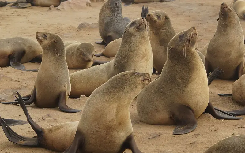
| Cape Cross Seal Reserve | 120–130 km | Up to 210,000 Cape fur seals; replica of a 1486 Portuguese cross |
| Ugab River Gate | approx. 200 km | Entrance to Skeleton Coast National Park |
| Terrace Bay | approx. 165 km past Ugab Gate | End of the public road; NWR accommodation |
Distances along the C34 are approximate and depend on where you start in town. The C34 is a salt road: gravel and sand bound with salt water into a hard, smooth surface that feels almost like tar. It is fast in dry conditions, but it becomes slippery as soap when morning fog dampens it. Keep to about 80 km/h, watch for potholes, and slow right down when the surface looks dark and wet.
Day trip: Swakopmund to Cape Cross and back#
This is the classic, very manageable Skeleton Coast taster. It covers about 250 km return and takes 7–9 hours with stops.
Morning: Wlotzkasbaken and the lichen fields#
Leave Swakopmund around 08:00. After about 30 km you reach Wlotzkasbaken, a holiday settlement of brightly painted shacks, each with its own raised water tank. It is a strange, photogenic place, especially when the fog swirls around it.
The gravel plains north of Wlotzkasbaken hold some of Namibia’s most important lichen fields. These slow-growing organisms live on fog moisture and look like dry grey crusts until the fog arrives, when they unfurl and turn faintly green. Vehicle tracks across them can last for decades, so stay on the main road and established tracks.
Zeila shipwreck#
About 14 km south of Henties Bay, opposite an angling spot known as Die Walle, a short track leads from the C34 to a gravel parking area above the beach where the Zeila lies in the surf. The old South African trawler had been sold for scrap and was being towed from Walvis Bay towards India when the tow line broke on 25 August 2008, and she drifted onto the sandbank. Cormorants nest on what is left of her, and she is the most photographed wreck on the coast simply because she is the easiest to reach.
The wreck changes fast: compare old photos and you will see how much of the hull has rusted away and sunk since 2008, and waves now wash right over the stern. The access track and parking have been improved and are fine in a normal car. Do not try to wade or climb out to the wreck; the surf and the rusting steel are genuinely dangerous.
Informal sellers sometimes set up near the wreck, mostly offering semi-precious stones and crafts. Be polite but firm if you don’t want to buy, and don’t leave your car unlocked or unattended with valuables inside.
Henties Bay#
Henties Bay is a fishing and holiday town with fuel, a supermarket, ATMs and a few cafés and restaurants. It is the last reliable place to buy fuel before Cape Cross and the national park. Shore angling is the town’s main draw, and in season you’ll see long lines of rods along the beach. Our Henties Bay guide covers where to eat and stay.
From Henties Bay, the C35 heads inland towards Uis and the Brandberg. This is also the route to Spitzkoppe; see our Spitzkoppe day trip guide.
Cape Cross Seal Reserve#
Another 50–60 km north brings you to Cape Cross, home to one of the largest Cape fur seal colonies in the world. Numbers peak at around 210,000 during the breeding season, when pups are born from late November into December. A boardwalk about 200 m long lets you watch the seals at very close range without disturbing them.
Cape Cross is also where Portuguese navigator Diogo Cão landed in 1486 and erected a stone cross (padrão). The original was taken to Germany in the colonial era; a replica stands on the site today.
- Fees: Cape Cross is in Namibia’s premium park category. Under the fees gazetted from 1 April 2026, foreign adults pay N$280 per day, SADC nationals N$180 and Namibians N$60, plus N$60 for a car with up to 10 seats; children under 8 are free. Fees are paid at the reserve office.
- Opening hours: Hours vary by season, but are generally from morning (08:00 or 10:00, depending on the time of year) until 17:00. Check before you go.
- Smell and noise: Expect both, in industrial quantities. Most people stop noticing after 10 minutes.
For full details, including the best time of year, photography tips and an overnight option, see our Cape Cross seal colony guide.
Return to Swakopmund#
Head back the same way, aiming to be home before dark, since stray animals and unlit trucks make night driving risky. If you have a 4x4 and time, a scenic return inland via the C35 and Uis is possible, but it turns this into a very long day.
Going further: Skeleton Coast National Park#
To see the Skeleton Coast at its wildest, with fewer people, more wrecks and desert-adapted wildlife, you need to go beyond the Ugab River into the national park.
Gates and permits#
The park has two public entry gates:
- Ugab River Gate (southern entrance on the C34, about 200 km north of Swakopmund)
- Springbokwasser Gate (eastern entrance on the C39 from Khorixas and Damaraland)
Gate times (as most recent sources give them; confirm with NWR before you set off):
| Gate | Entry | Exit |
|---|---|---|
| Ugab River Gate (south) | approx. 07:30–15:00 | until approx. 19:00 |
| Springbokwasser Gate (east) | approx. 07:30–17:00 | until approx. 19:00 |
Some older guidebooks give a stricter rule (enter before 13:00, exit before 15:00), and staff have discretion, so the safe plan is to reach the Ugab gate by midday. Arrive after the cut-off without a booking and you will be turned back, which from Ugab means a 200 km drive back to Swakopmund or a night in Henties Bay.
There are two ways in:
- Transit permit: issued at the gate, for driving straight through between Ugab and Springbokwasser in one day. You must leave through the other gate, not the one you came in by, and transit permits don’t let you detour north to Torra Bay or Terrace Bay.
- Overnight stay: with a confirmed booking at Terrace Bay (chalets, open all year) or Torra Bay campsite (open only in December and January). Bookings go through Namibia Wildlife Resorts (NWR), whose office in Swakopmund can help.
Park fees follow the premium category: N$280 per foreign adult per day from 1 April 2026, plus N$60 for a normal car. There is no fuel and no mobile signal inside the park, so fill up in Henties Bay and carry spare water.
Torra Bay and Terrace Bay#
Torra Bay sits on the coast a short way north of the C39 turn-off to Springbokwasser, and in season it is a shore-angling camp first and foremost. It has around 60 pitches in rows marked out with stones, a small but well-stocked shop and clean ablutions. Namibian anglers take the front row and wall their camps with two-metre windbreaks, so pitch further back if you want shelter and some quiet, since fishermen work the beach at night too. Galjoen, kabeljou (silver kob), steenbras and blacktail are the main catches, with strict size limits.
Terrace Bay, roughly 50 km further north, is the end of the road for ordinary visitors: a small NWR resort with chalets and a restaurant around a bay, and nothing beyond it but concession land. The drive from Torra Bay is the highlight, along a hard gravel road between salt pans, whale bones, pebble beaches and low rocky headlands. Never park on the sand within reach of the waves.
What you’ll see#
- Shipwrecks: rusting hulls and wreckage lie scattered along the beaches between the Ugab River and Terrace Bay, some visible from the road and others reached by short sandy tracks. Ask at the gate for current access.
- The Ugab River mouth: a dry riverbed for most of the year, where the gate and the start of the park sit amid stark gravel plains and low dunes.
- Desert wildlife: black-backed jackals, brown hyenas, springbok and oryx; desert-adapted elephants and lions occasionally move along the river valleys in the north, but sightings are rare.
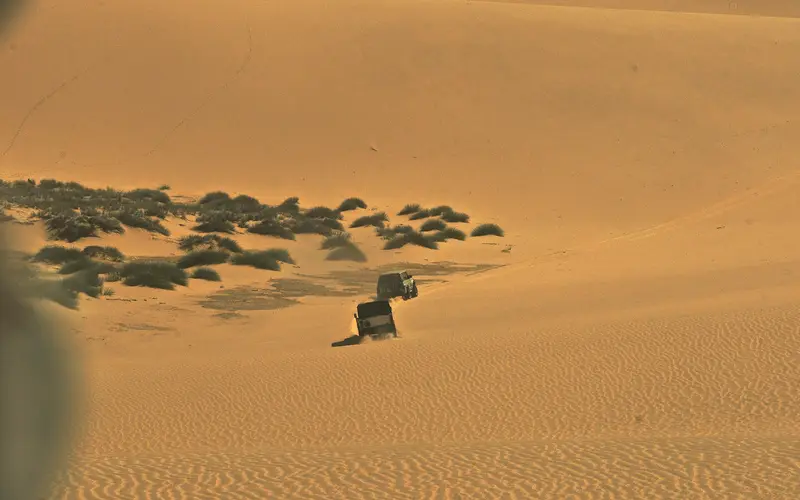
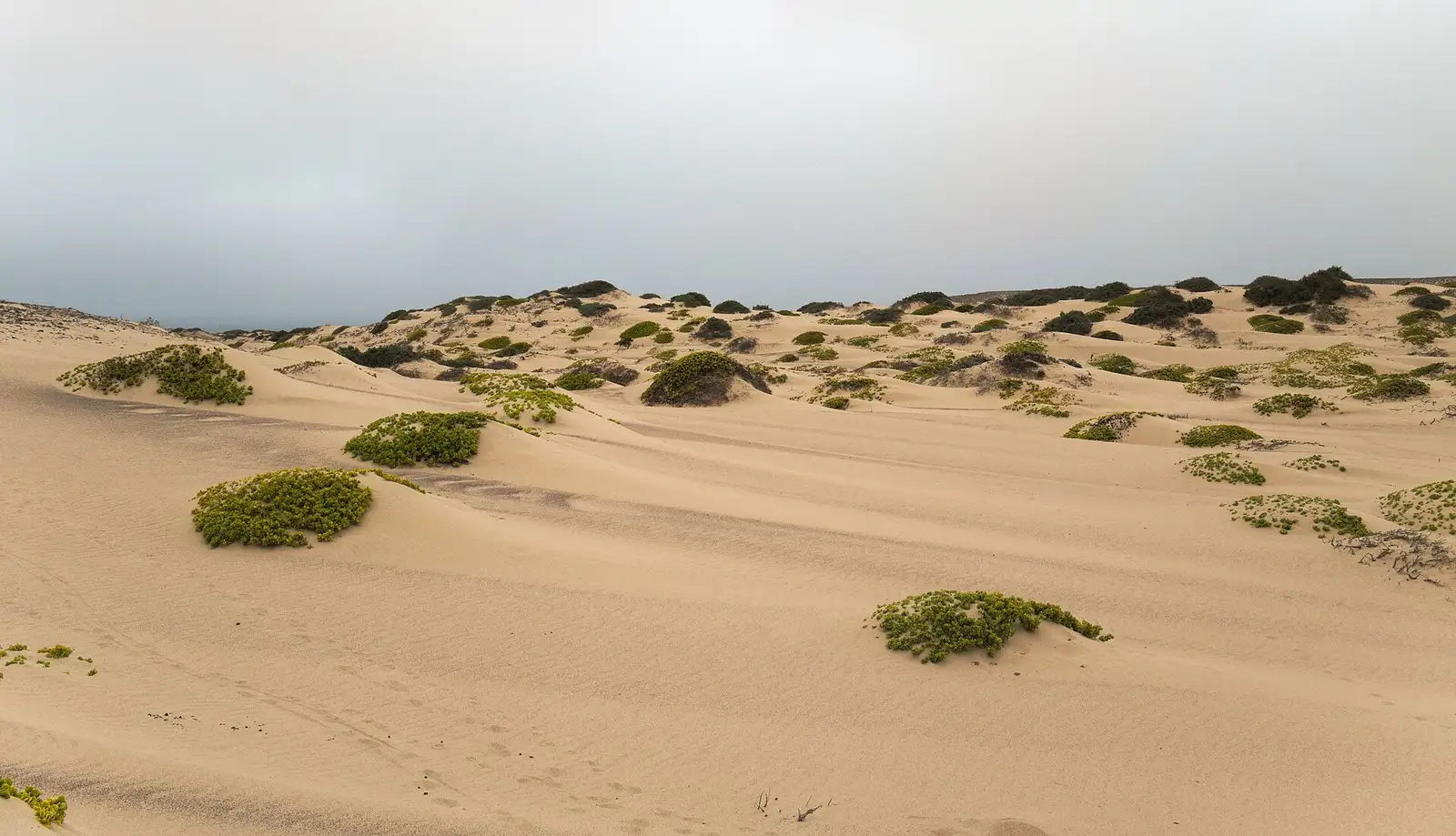
- Dunes and gravel plains: in many places, the dunes run right down to the surf.
A 2–3 day route#
- Day 1: Swakopmund → Cape Cross → Ugab Gate → Terrace Bay (overnight; book ahead).
- Day 2: Explore around Terrace Bay, then exit via Springbokwasser into Damaraland (Twyfelfontein, Palmwag area).
- Day 3: Continue to Etosha, or loop back towards Swakopmund via Uis and the Brandberg.
This route works well as part of a bigger Namibia trip, connecting the coast with Damaraland and Etosha without retracing your steps; our Namibia road trip itinerary shows how it fits into two or three weeks. Read our car rental guide before booking a vehicle, because gravel-road and tyre cover matter here.
Guided Skeleton Coast tours from Swakopmund#
If you don’t have a car, or don’t want to drive the salt road, guided tours are easy to arrange in Swakopmund.
| Tour type | Approx. duration | Approx. 2026 price per person | What’s included |
|---|---|---|---|
| Cape Cross half/full day | 5–9 hours | N$2,000–N$4,000 | Transport, guide, park fees, often lunch or snacks; usually Zeila wreck and Henties Bay stops |
| Multi-day Skeleton Coast & Damaraland safari | 3–7 days | Varies widely | Camping or lodge accommodation, park fees, meals |
| Scenic flight | 1.5–3 hours | Several thousand N$, depending on route and seats filled | Aerial views of wrecks, seal colonies and dunes |
| Fly-in safari (northern park) | 3–6 days | From approx. US$10,000 per person | Light aircraft, exclusive concession camps |
The cheapest option for a group is often to hire a car and drive yourselves. For solo travellers, a shared tour is usually better value. Our Swakopmund tours and packages guide explains how to compare operators, and our best day trips from Swakopmund guide shows how the Skeleton Coast compares with Sandwich Harbour and Spitzkoppe.
Best time to visit#
The Skeleton Coast can be visited all year. Temperatures are cool, typically in the mid-teens to low twenties °C, and it barely ever rains.
- Seals: Late November to December for pups at Cape Cross, though the colony is busy all year.
- Clearer skies: September to April generally brings more sunny afternoons.
- Fog: Expect it most mornings year-round. It is part of the atmosphere and makes for moody photos, but drive slowly on the salt road.
- Fishing season: Torra Bay only opens in December–January, when anglers fill it.
For month-by-month detail, see our Swakopmund weather guide, and for how the coast compares with Etosha and the desert at different times of year, the best time to visit Namibia.
What to bring#
- A full tank of fuel and, for the national park, a jerrycan if your car’s range is short
- At least 5 litres of drinking water per person, plus snacks or a picnic
- Warm layers and a windproof jacket, even in summer
- Sunscreen, sunglasses and a hat (UV gets through the fog)
- Binoculars and a zoom lens for seals, birds and wrecks
- A working spare tyre (ideally two for the park), jack and tyre pressure gauge
- Cash for park fees and small purchases (card machines sometimes fail)
- Offline maps downloaded before you leave Swakopmund
Our Swakopmund packing list has a full checklist.
Safety and rules#
- Tell someone your plans and your expected return time. There is no mobile signal for long stretches. Our is Namibia safe guide covers road safety in more depth.
- Drive to conditions. Many accidents on the C34 involve speeding or overturning on wet salt surfaces.
- Stay on established tracks. Off-road driving damages lichen fields and is illegal in the parks.
- Don’t swim. The water is very cold and currents are strong.
- Keep your distance from seals. They bite, and mothers abandon pups that are disturbed.
- Don’t remove anything from wrecks, beaches or the parks, including bones, stones and wreck fragments.
- Fishing needs a licence, available from the Ministry of Fisheries; local tackle shops can advise.
Common mistakes#
- Thinking Cape Cross is “the Skeleton Coast National Park”. It isn’t. The national park starts 70–80 km further north at the Ugab River.
- Arriving at the Ugab Gate in the afternoon and finding entry already closed. Aim for midday.
- Planning to camp at Torra Bay outside December–January. It is closed the rest of the year.
- Driving onto the beach at high tide. If you leave the road for the sand, check the tide times first and never park within reach of the waves.
- Running low on fuel. Henties Bay is your last reliable fuel stop going north.
- Driving the salt road like a tarred road. It looks smooth, but it isn’t tar, especially when wet.
- Leaving valuables visible at the Zeila wreck and other roadside stops.
The Skeleton Coast is one of the most atmospheric drives in Africa, and the stretch from Swakopmund to Cape Cross is easy enough for almost anyone. For the full picture of what else the region offers, start with our Swakopmund travel guide.
Photo gallery
Frequently asked questions
Can you do the Skeleton Coast as a day trip from Swakopmund?
You can do the southern coast as a day trip: Wlotzkasbaken, the Zeila wreck, Henties Bay and Cape Cross. The Skeleton Coast National Park proper starts at the Ugab River, about 200 km north, so it needs a very long day or an overnight stay.
Do I need a 4x4 for the Skeleton Coast?
No. The C34 coast road is a salt-surfaced road that a normal car can drive carefully. A 4x4 is only needed for sandy side tracks, beach access points and some routes inside the park.
Do I need a permit for the Skeleton Coast National Park?
Yes. Through-travellers get a transit permit at the Ugab or Springbokwasser gate and must leave through the other gate the same day; overnight stays need a booking at Terrace Bay or Torra Bay. Most current sources give entry until about 15:00 at Ugab and 17:00 at Springbokwasser, with exit by about 19:00, but confirm with Namibia Wildlife Resorts.
When is Torra Bay open?
Torra Bay campsite opens only in December and January, mainly for shore anglers. Terrace Bay, further north, has chalets rather than camping and is open all year.
Why is it called the Skeleton Coast?
The name comes from the whale and seal bones that once littered the beaches and the many ships wrecked by fog, currents and shifting sandbanks along this coast.
What is the best time to visit the Skeleton Coast?
It can be visited all year. Late November to December is seal pupping season at Cape Cross, while the clearest days tend to come between September and April. Fog is common in the mornings year-round.
Is the Skeleton Coast dangerous?
Not if you plan properly. The real risks are running out of fuel, breaking down without phone signal, driving too fast on the salt road and swimming in the very cold sea, so carry water, fuel and a spare tyre and tell someone your plans.