Swakopmund’s compact old town is best explored on foot. This self-guided walk covers 14 stops in a 3–4 km loop, from the lighthouse and the Mole through the colonial-era core to the old railway station and back to the jetty for sunset. It takes 2–3 hours, costs nothing unless you go into the museums, and also covers what the facades don’t show: the town’s role in the 1904–1908 genocide of the Ovaherero and Nama peoples.
Interactive
Map of Swakopmund & the Namib coast
Tap a pin for distances from Swakopmund and a link to the full guide.
List all 22 places with distances
- Swakopmund JettyIn town
The historic iron jetty from the German colonial era, now with a seafood restaurant at the end and the town's classic sunset view.
- Lighthouse & the MoleIn town
Swakopmund's red-and-white lighthouse and the Mole breakwater beside Palm Beach, the heart of the seafront promenade.
- Woermann HouseIn town
A landmark German colonial trading house with a lookout tower, one of the highlights of a walk through the old town.
- Swakopmund MuseumIn town
A long-running museum near the Mole covering the region's natural history, peoples and colonial past.
- Kristall GalerieIn town
A gallery built around an enormous quartz crystal cluster, with a gemstone shop and a mineral display.
- Mondesa township4 km · 10 min
Swakopmund's largest township, best visited on a local-led tour with home visits, food and music.
- Dune belt (sandboarding & quads)6 km · 10 min
The dunes just south of the Swakop River along the B2, where most sandboarding, quad-biking and Living Desert tours take place.
- Walvis Bay Waterfront35 km · 30 min
The departure point for dolphin and seal cruises, with oyster and seafood restaurants on the water.
- Dune 738 km · 35 min
One of the tallest dunes in the area, on the edge of Walvis Bay, with a steep climb, a picnic site and an MEFT entrance fee.
- Walvis Bay Lagoon (flamingos)38 km · 35 min
A Ramsar wetland where thousands of greater and lesser flamingos feed close to the Esplanade, free to visit.
- Pelican Point65 km · 1 h 30 (4x4 only, or by boat)
A sandspit with a 1932 lighthouse and a large seal colony, best reached on a boat cruise or kayak tour from Walvis Bay.
- Zeila shipwreck60 km · 45 min
A fishing trawler stranded in the surf in 2008, about 14 km south of Henties Bay and now home to cormorants.
- Henties Bay75 km · 50 min
A small angling and holiday town with fuel and seafood restaurants, the gateway to Cape Cross and the Skeleton Coast.
- Moon Landscape35 km · 40 min (gravel)
Eroded ridges and valleys carved by the Swakop River, best in early-morning or late-afternoon light (park permit needed).
- Goanikontes Oasis40 km · 50 min (gravel)
A green oasis in the Swakop riverbed with a restaurant, pool and shady campsites, the natural lunch stop on the Welwitschia Drive.
- Welwitschia Plains65 km · 1 h 15 (gravel)
A gravel plain of ancient Welwitschia mirabilis plants, including a fenced giant estimated at well over 1,000 years old.
- Sandwich Harbour80 km · 2 h (4x4 only, tide-dependent)
Towering dunes plunging into the Atlantic beside a Ramsar lagoon, reached on guided 4x4 tours at low tide.
- Cape Cross Seal Reserve125 km · 1 h 30
One of the world's largest Cape fur seal colonies, with up to about 210,000 seals, beside a replica of Diogo Cão's 1486 stone cross.
- Spitzkoppe150 km · 2 h
Granite peaks rising about 700 m above the plains, with a famous rock arch, San rock art and a community campsite.
- Brandberg220 km · 3 h
Namibia's highest mountain (2,573 m), home to the White Lady rock painting and thousands of other rock-art sites.
- Windhoek360 km · 4 h
Namibia's capital and main international gateway, about four hours inland on tarred roads.
- Sossusvlei400 km · 6 h (mostly gravel)
Namibia's famous red dunes and Deadvlei, an overnight trip via Walvis Bay, the Kuiseb Pass and Solitaire.
Map data © OpenStreetMap contributors. Distances are by road from Swakopmund town centre and approximate.
Before you start: why the history matters#
Swakopmund was founded in 1892, when Captain Curt von François chose this spot as a harbour for the German colony of South West Africa. Walvis Bay, the only natural deep-water harbour nearby, belonged to Britain. Between the 1890s and the First World War, the town grew quickly as the colony’s main port of entry. Most of the buildings you’ll see on this walk date from that short period, roughly 1894 to 1914.
These buildings are handsome, and many are national monuments. But they were built during a colonial occupation, and in the case of Swakopmund, partly by forced labour. After the Ovaherero and Nama rose against German rule in 1904, German forces waged a campaign that historians describe as the first genocide of the 20th century. Tens of thousands of Ovaherero and Nama people were killed or died of starvation, thirst and disease. Commonly cited estimates are around 65,000 Ovaherero (about 80% of the population) and 10,000 Nama (about half).
Swakopmund held concentration camps from 1904 to 1908. Research by the Swakopmund Museum identified five camps in the town: four run by private businesses to house forced labourers, and one under military control. Prisoners, including women and children, were made to unload ships, build railway lines and work for colonial companies, and many died. The town’s death register for just seven months, from July 1905 to February 1906, records the deaths of 342 Ovaherero women. Estimates for the total number who died in Swakopmund’s camps run into the thousands; the research group Forensic Architecture puts it at around 2,000 Ovaherero alone. Most were buried in shallow, unmarked graves on the edge of town (see the extension at the end of this walk).
In 2021, Germany formally acknowledged these events as genocide and pledged €1.1 billion in development funding over 30 years. Many Ovaherero and Nama representatives reject that agreement as inadequate and as negotiated without them, and the debate continues. In 2025, Namibia held its first national Genocide Remembrance Day on 28 May.
Keeping this history in mind won’t spoil the walk. It gives you a much truer picture of the town than the “little Bavaria by the sea” postcard image.
The route at a glance#
| # | Stop | What it is | Approx. date |
|---|---|---|---|
| 1 | Lighthouse | Swakopmund’s landmark tower | 1902–1903, raised 1910 |
| 2 | Swakopmund Museum | Natural and colonial history; genocide exhibition | Founded 1951 |
| 3 | The Mole | Failed harbour breakwater | Built c. 1899–1903 |
| 4 | State House | Former magistrates’ court | 1902 |
| 5 | Marine Memorial | Contested colonial war memorial | 1908 |
| 6 | Café Anton / Schweizerhaus | Classic coffee stop | — |
| 7 | Woermann House | Trading company headquarters, now a library | 1894, extended 1903–1904 |
| 8 | Hohenzollern Building | Former hotel with Atlas statue | 1904–1906 |
| 9 | Tobias Hainyeko Street & Brauhaus Arcade | Shopping streets, arcades, crafts | Early 1900s–present |
| 10 | Evangelical Lutheran Church | Neo-baroque church | 1910–1912 |
| 11 | Old Railway Station (Swakopmund Hotel) | Station building, now a hotel | 1901 |
| 12 | Alte Kaserne | Old barracks, later a school and youth hostel | 1905–1906 |
| 13 | Prinzessin-Rupprecht-Heim | Former military hospital, now hotel and retirement home | 1901–1902 |
| 14 | The Jetty | Iron jetty, now with a restaurant | Wooden 1905; iron from c. 1912 |
Take a photo of this table or save the page offline before you go. The whole loop is flat and mostly on paved pavements.
The walk, stop by stop#
1. The Lighthouse#
Start at Swakopmund’s red-and-white lighthouse, just off Strand Street and close to the sea. Building began in 1902, and the tower was raised to roughly its present height in 1910. It is still a working lighthouse, so you can’t go inside, but it is the easiest landmark in town for meeting up and getting your bearings.
Look out for the craft market near the lighthouse, where vendors sell carvings, baskets and jewellery. It is a good place to buy directly from makers, but browse first and only bargain politely.
2. Swakopmund Museum#
Right by the sea, near the lighthouse and the Mole, the Swakopmund Museum was founded in 1951 by a local dentist, Alfons Weber. Its displays cover desert ecology, minerals, ethnography and the colonial period.
For decades the museum largely told the settler story. It now includes an exhibition on the 1904–1908 Ovaherero and Nama genocide, including research on the Swakopmund concentration camps. If you visit only one museum in town, give this exhibition time.
- Hours: usually daily, approx. 10:00–17:00
- Entry: approx. N$30–N$80 (2026); confirm on arrival
3. The Mole#
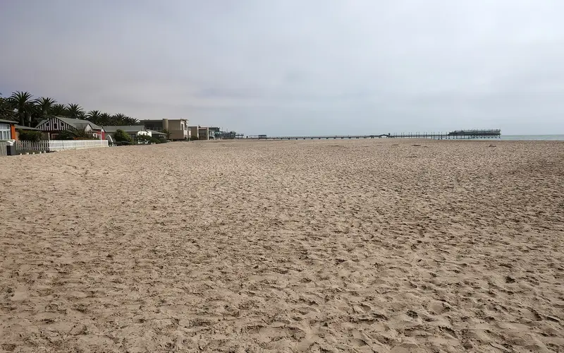
Walk a few minutes along the seafront to the Mole, the massive stone breakwater built around 1899–1903 to create a harbour. It failed within a few years. The Benguela Current carried sand into the sheltered water, and the “harbour” silted up into the beach you see today. That beach, Palm Beach, is now the town’s main swimming spot and a good place to watch the sunset; see our Swakopmund beaches guide.
From the end of the Mole, look back for a view of the whole seafront skyline: the lighthouse, the museum and the colonial rooftops behind. The large modern building at the root of the Mole is the Strand Hotel.
4. State House (Kaiserliches Bezirksgericht)#
Head inland from the Mole to the large building surrounded by gardens and a wall: the former Kaiserliches Bezirksgericht (Imperial District Court). It was built in 1902 as the magistrates’ court, extended in 1905, and given its tower in 1945. After the First World War, it became a holiday residence for the territory’s administrators, and since independence it has served as the Namibian President’s coastal residence. Admire it from outside only, be discreet with your camera, and don’t photograph security staff or loiter at the gates.
5. The Marine Memorial (Marine-Denkmal)#
Beside State House stands the Marine Memorial, unveiled in 1908. Commissioned by the German Marine Infantry in Kiel, it honours German marines killed fighting the Ovaherero in 1904–1905. In other words, it commemorates the soldiers of the colonial campaign, not its victims.
The statue is one of the most contested monuments in Namibia. Activists have called for its removal, and it has been splashed with red paint in protest. It is a good place to pause and remember who isn’t commemorated here.
6. Café Anton and the Schweizerhaus#
Time for a break. Café Anton, at the Schweizerhaus Hotel near the seafront, is known for its coffee, apple strudel and other German-style cakes. It isn’t cheap, but it is a Swakopmund classic. For other options nearby, see our top restaurants in Swakopmund.
7. Woermann House and the Damara Tower#
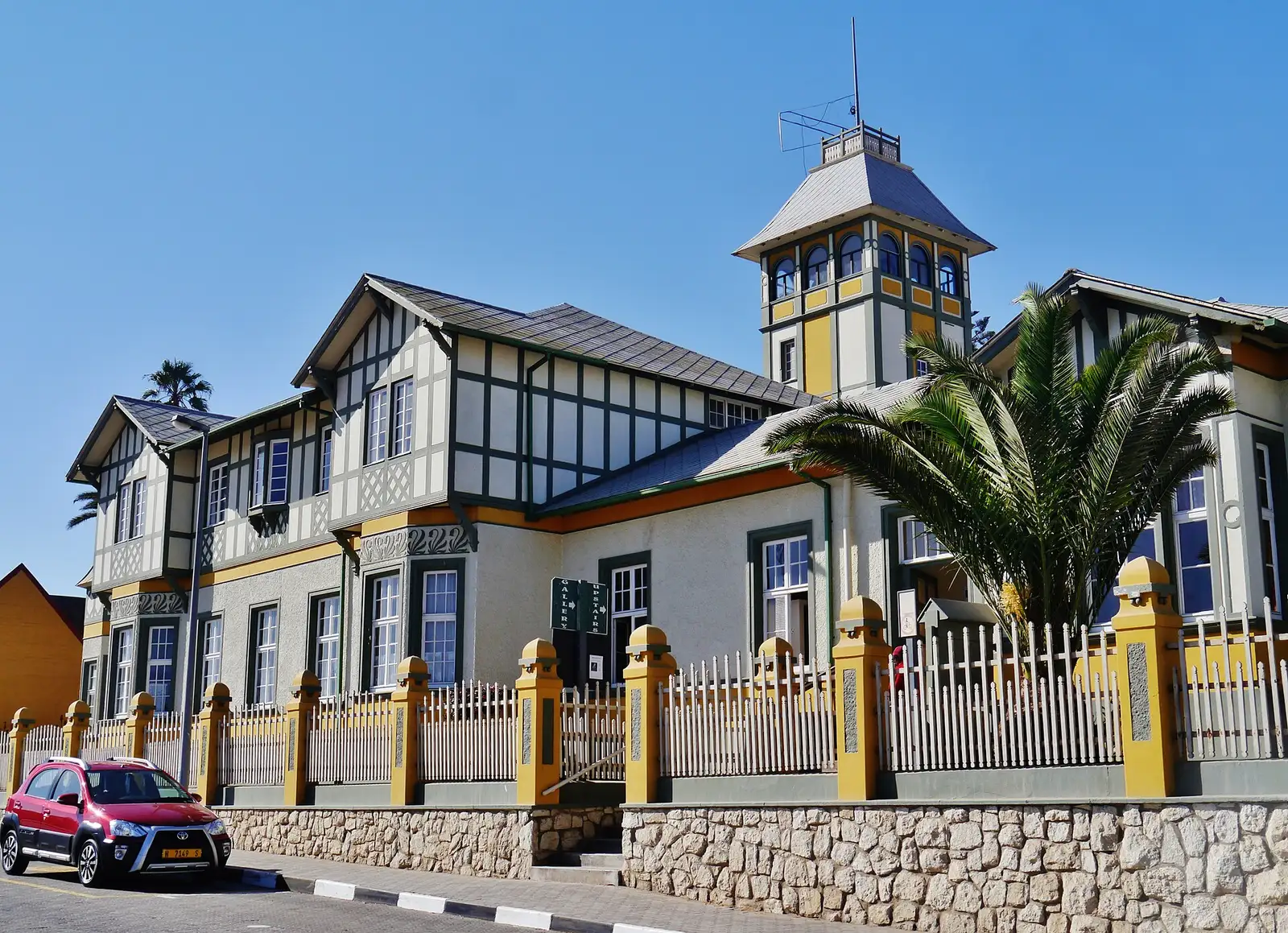
Walk up Bismarck Street to find Woermann House, recognisable by its tall tower. It was built in 1894 to plans by the architect Friedrich Höft for the Hamburg merchant and shipowner Adolph Woermann and his Damara and Namaqua Trading Company, with extra offices added in 1903–1904. The Woermann line carried goods, settlers and soldiers between Hamburg and the colony. The Damara Tower served as a lookout for incoming ships, a water tower and a flagpole.
After the South African takeover, the building was used as a hostel from 1924 to 1972, then fell into disrepair. Declared a national monument in 1971, it was restored and reopened in 1976, and it now houses the town’s public library. Step into the courtyard during library hours. Woermann-linked businesses were among the private firms that relied on forced labour during the war, a reminder of how commerce and colonial violence were entangled.
8. The Hohenzollern Building#
Continue to Tobias Hainyeko Street for the ornate neo-baroque Hohenzollern Building, built between 1904 and 1906 by and for the businessman Hermann Dietz, whose initials “HD” are still on the northern gable. Look up to see the statue of Atlas holding the globe on the roof. The Hohenzollern Hotel it housed never did well, and Dietz rented parts of the building to the town administration. It became a national monument in 1972 and is now private apartments, so admire it from the street.
9. Tobias Hainyeko Street and the Brauhaus Arcade#
Wander along Tobias Hainyeko Street and through the Brauhaus Arcade, a pedestrian lane of shops, cafés and the Swakopmund Brauhaus. Look out for the local craft sellers and the Die Muschel bookshop, worth a browse if you’d like to read more about Namibian history. Tusk T-shirts, a Swakopmund company founded in 1990 and in the arcade since 2001, designs and screen-prints its shirts in town, which makes them a better souvenir than most.
This is also a good spot to notice the town’s layers: colonial-era facades next to 1970s blocks and modern glass, and street names honouring independence-era figures such as Tobias Hainyeko, a PLAN commander, and Libertina Amathila, a liberation activist and later deputy prime minister.
10. The Evangelical Lutheran Church#
Head inland on Daniel Tjongarero Avenue to the corner with Otavi Street for the German Evangelical Lutheran Church, built between 1910 and 1912 in neo-baroque style. Its stained-glass windows were donated from Bremen. It is still an active church, so respect services if you visit on a Sunday. Next door, the old Namib High School building dates from the same era.
11. The Old Railway Station (Swakopmund Hotel)#
A few blocks east, on Theo-Ben Gurirab Avenue, is the town’s grandest building: the old railway station, completed in 1901 and easy to spot by its turret roofs. It served the State Railway line to Windhoek, built with forced and contract labour, and remained a station for decades.
It was converted into the Swakopmund Hotel and Entertainment Centre in the 1990s. The historic station building now forms part of the hotel’s public areas, so you can walk in to see the interior and have a drink. Our Swakopmund Hotel & Entertainment Centre guide has more on the building today.
12. The Alte Kaserne (Old Barracks)#
Now head south-west through the old town towards the sea. On the southern side of the centre, a few blocks from the jetty, stands the Alte Kaserne, a fort-like building with crenellated walls and corner turrets. It was built in 1905–1906 to house the men of the 2nd Imperial Railway Construction Company, who built the jetty, and was later used by Schutztruppe soldiers. It served as a school until 1993 and then as a youth hostel. Its two wings, 55 m and 45.5 m long, with two-storey towers in the middle, make it a clear statement of the colonial state’s power, and the building still appears on the town’s coat of arms.
13. Prinzessin-Rupprecht-Heim#
Right next door, at Anton Lubowski Street 15, the single-storey Prinzessin-Rupprecht-Heim was built in 1901–1902 as a Lazarett (military hospital) for the Schutztruppe, designed by Carl Schmidt; the barracks were deliberately built beside it. The army took over its running during the 1904–1908 war. In 1914 it reopened as a Red Cross convalescent home named after Marie Gabrielle, wife of the Bavarian Crown Prince Rupprecht, and the rooms are still named after Bavarian towns whose Red Cross branches paid for the conversion. Today about half the building is the Hotel Prinzessin Rupprecht and half a retirement home. Together with the barracks, it shows how heavily militarised the town became around the time of the war.
14. The Jetty#
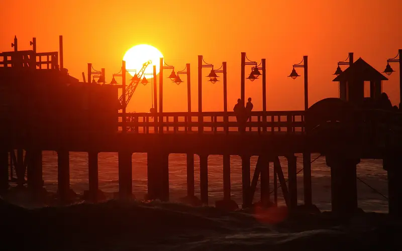
End your walk on the jetty at sunset. A wooden jetty was built from 1905 to replace the failed harbour at the Mole, but woodworm and Atlantic swells quickly damaged it. Work on a far longer iron and concrete jetty began around 1912 (sources give dates from 1911 to 1914), planned to reach 500–640 m beyond the breakers. The First World War halted it, and after South African forces took over in 1915 Walvis Bay became the territory’s port, so the jetty was never finished and became a promenade.
By the 1990s the iron structure was unsafe and was closed in 1998. After a partial reopening in 2008, it was rebuilt and fully reopened in August 2010, about 262 m long, with the Jetty 1905 restaurant at the end. Walking along it is free at the time of writing, and it is the best sunset spot in town.
Extension: the Memorial Park and the genocide graves#
If you have a car or take a taxi, finish the history of the town where it is most honestly told. On the edge of Swakopmund in Kramersdorf, the Memorial Park (formerly the African Cemetery) marks the burial ground of thousands of Ovaherero and Nama people who died in the town’s concentration camps. Behind the newer headstones, the graves of the victims show only as low mounds of sand, row after row. Ovaherero traditional leaders unveiled a memorial stone here in 2007.
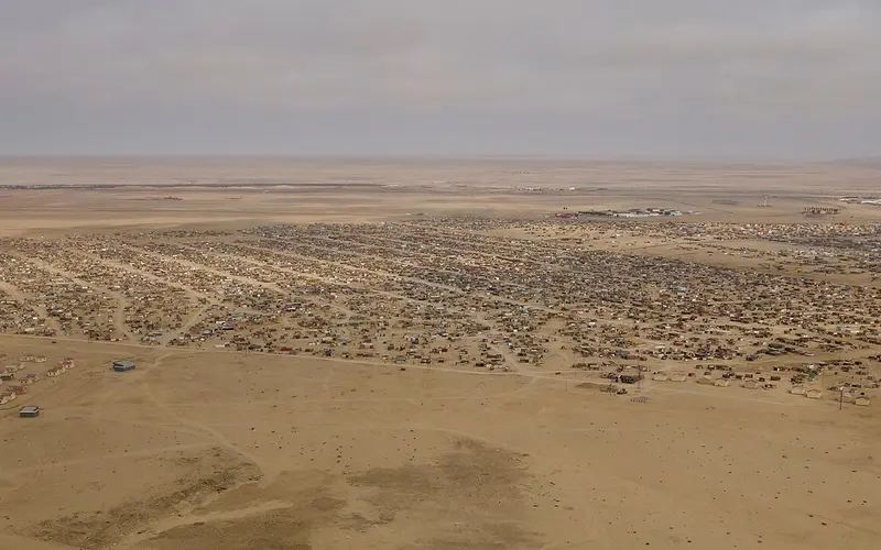
The site is under pressure: forensic archaeologists surveying it have recorded graves damaged by vehicle tracks, erosion and housing development on its fringes. Visit quietly, keep to paths, do not drive or walk over the mounds and do not move anything. The best way to go is with a local guide or as part of a Mondesa township tour, as guides can explain the history and the families’ continuing campaign for recognition.
Practical tips for the walk#
- When to go: Late morning, after the fog has burned off, is ideal. Starting around 14:00 means you’ll reach the jetty for sunset, but the museum closes around 17:00, so visit it first.
- What to bring: Water, a windproof layer, sunscreen and a hat. The sun is strong even when it feels cool.
- Photography: Most facades photograph best in the late afternoon. Ask before photographing people, including craft sellers.
- Accessibility: The route is flat, and most of it is paved and accessible by wheelchair or pram, though some kerbs are high and the jetty can be windy.
- Guided alternative: Several local operators offer guided historical city tours, and some cover the genocide sites in more depth than any information board can. See our best things to do in Swakopmund for more ideas.
- Stay in the history: the Hansa Hotel, dating from 1905, and the Prinzessin Rupprecht (stop 13) let you sleep in buildings from the colonial era.
- Read before you go: The Kaiser’s Holocaust by David Olusoga and Casper W. Erichsen (2010) is the most thorough account in English of the genocide and its links to later German history, including the fact that Heinrich Göring, father of the Nazi leader Hermann Göring, was the colony’s first Reichskommissar.
Common mistakes#
- Visiting only the pretty buildings. Without the context of the war and the camps, you only get half the story.
- Treating State House as a museum. It is an official residence: no entry, and no loitering at the gates.
- Arriving at the museum at 16:45. Give it at least an hour, especially for the genocide exhibition.
- Leaving the jetty for another day. It is best at the end of a walk, at sunset.
Make it a full day#
Combine this walk with lunch in the centre and a sunset at the jetty, or pair it with a morning Mondesa township tour to see how Swakopmund’s history shaped the town’s present-day geography. For more budget-friendly ideas, see our free things to do in Swakopmund, and to fit everything into a short stay, try our 3 days in Swakopmund itinerary. For the bigger picture of the town, start with our Swakopmund travel guide.
Photo gallery
Frequently asked questions
How long does a walking tour of Swakopmund take?
The loop in this guide takes about 2–3 hours at a relaxed pace. Add an hour or two if you visit the Swakopmund Museum and stop for coffee along the way.
Can you go inside the historic buildings in Swakopmund?
Some, yes. Woermann House is a public library, the old railway station is now a hotel with public areas, and the museum is open daily. Others, such as State House, are official or private property and can only be viewed from outside.
Where can I learn about the Herero and Nama genocide in Swakopmund?
The Swakopmund Museum now has an exhibition on the 1904–1908 genocide, and the small, privately run Swakopmund Genocide Museum focuses entirely on it. The Memorial Park in Kramersdorf, on the edge of town, marks the unmarked graves of thousands of camp victims; local guides can take you there.
Where is the Alte Kaserne in Swakopmund?
The Alte Kaserne (old barracks) stands on the southern side of the old town, right beside the Prinzessin-Rupprecht-Heim on Anton Lubowski Street and a short walk from the jetty. It is a national monument and appears on the town's coat of arms.
Is it safe to walk around Swakopmund's old town?
Yes, during the day the centre is busy and relaxed. Keep your phone and camera secure, don't leave bags unattended, and take a taxi rather than walking long distances after dark.
Why were Swakopmund's street names changed?
After independence in 1990, many colonial-era street names were replaced with the names of Namibian independence figures. Kaiser-Wilhelm-Strasse, for example, became Sam Nujoma Avenue, so older maps and some signs still use the old names.